
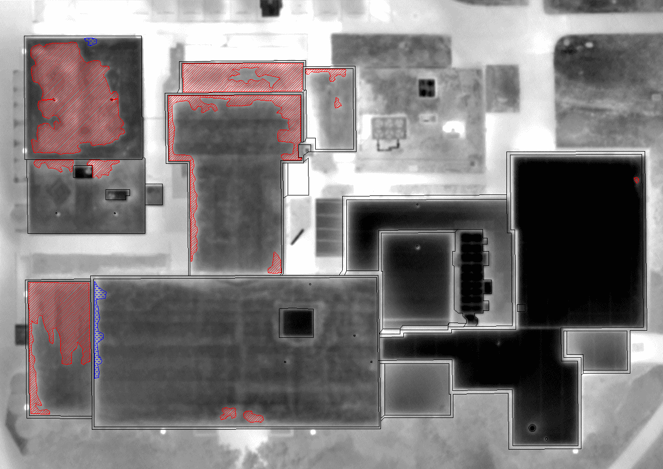
Commercial Roof Zone Mapping in Austin, TX
A dimensioned, photo-keyed roof zone map is the foundation of every credible condition report, capital plan, and warranty compliance document. We produce roof zone maps for Austin commercial buildings that remain useful for the life of the asset, not diagrams that are obsolete when the next manager arrives.
Most Austin commercial buildings do not have a current, accurate roof zone diagram on file. Owners frequently inherit hand-sketched diagrams from the original installation, or PDFs from a prior contractor that do not reflect subsequent repairs, penetration additions, or equipment changes. When the roof needs work, whether it is a repair, an insurance assessment, or a capital replacement, the absence of accurate documentation means the first step is reconstructing a record that should already exist.
We produce dimensioned roof zone maps as a standalone deliverable and as the foundation document within every condition report, capital plan, and warranty compliance package we produce. The map is formatted to be useful across multiple cycles of ownership and management, it identifies zones by reference, keys photographs to locations, and shows every penetration, drain, and rooftop equipment item in its current position.
Austin's commercial real estate market has a high turnover rate in building management, incoming managers at Domain office buildings, South Congress retail strips, and East Austin mixed-use properties frequently have no usable roof documentation from prior ownership. A current zone map, kept in the building file and updated as conditions change, closes that gap without requiring the next manager to start from zero.
Dimensioned plan: The map shows the roof perimeter with field-measured dimensions, parapet and wall locations, roof level changes, and any structural features that affect drainage or membrane layout. We measure in the field; we do not scale from building plans that may not reflect as-built conditions. Austin commercial buildings from the 2000s construction boom frequently have discrepancies between the architectural drawings and the actual constructed dimensions.
Zone delineation: The roof is divided into zones based on drainage area, membrane section, or roof level, whichever produces the most useful reference structure for the building's configuration. Zone labels are simple alphanumeric references (Zone A, Zone B-1) that can be used consistently across all documentation produced for that building going forward.
Penetration and equipment inventory: Every rooftop penetration is marked on the map with a reference number keyed to a penetration schedule, drain, HVAC curb, vent pipe, conduit sleeve, skylight, antenna base, and any other penetration type. The penetration schedule logs size, type, current flashing condition at time of mapping, and last service date if known. This inventory is particularly useful for large Austin commercial buildings with dense rooftop equipment where individual penetrations are otherwise difficult to track.
Photo Keying and Condition Overlays
Every photograph taken during the inspection is keyed to the roof diagram by number. The photo key allows the owner, a subsequent contractor, or an insurance adjuster to locate any photographed feature or defect on the roof without re-walking the building. For Austin buildings where the property manager is not the person who will be on the roof, this connection between the document and the physical location is the practical value of the map.
Condition zone overlays layer the condition rating for each zone, Good, Fair, Poor, Replace, onto the base map using a simple color or shading scheme. The overlay produces an at-a-glance status view of the roof that can be communicated to a non-technical audience without requiring them to read a full narrative report. We update the overlay annually as part of the inspection program; the multi-year comparison shows condition change across the roof in a visual format.
For buildings where moisture survey has been performed, the saturation map overlays wet zone locations and moisture core results onto the base zone diagram. The combined document shows membrane surface condition, subsurface moisture, and penetration condition on a single reference document, the complete picture rather than three separate reports.
Digital Record-Keeping and Portfolio Mapping
We maintain roof zone maps digitally for every Austin building in our active management program. The digital file is updated when field conditions change, when a penetration is added, when a repair changes the membrane configuration in a zone, when equipment is relocated on the rooftop. The owner or facility manager can request the current map at any time and receive a file that reflects the current as-built condition.
For portfolio owners managing multiple Austin-area buildings, a consistent mapping format across all properties allows cross-building comparison. Condition ratings, remaining service life estimates, and capital projections are all referenced to the same zone structure across the portfolio. When a new manager takes over a property in the portfolio, the zone map is their orientation document for the roof, they can understand what they own by reading the map rather than walking an undocumented roof.
Post-construction closeout packages for new Austin commercial buildings include a roof zone map as a standard deliverable, the starting point for the asset's service life documentation. The closeout map shows the new installation in its as-built configuration, becomes the first record in the warranty compliance file, and is the document the first annual inspection updates.
How long does it take to produce a roof zone map for an Austin commercial building?
For a standard single-story Austin commercial building in the 20,000 to 60,000 sq ft range, field measurement and photograph documentation takes two to four hours on-site. The finished map is delivered within five business days as part of the condition report or as a standalone deliverable. Multi-story buildings with complex rooftop environments take longer on-site; the turnaround time is confirmed before the site visit.
Can you produce a roof zone map for a building you did not originally install?
Yes. We produce maps for any Austin commercial building regardless of who installed the roof or what documentation exists from prior work. We measure the current as-built configuration and document what we observe during the mapping visit. Prior installation records are useful context if they exist, but they are not a prerequisite.
What file format do you deliver roof zone maps in?
We deliver maps as PDF for immediate use and as a digital working file in a format compatible with standard facility management documentation systems. For portfolio owners who maintain their building records in a centralized platform, we can discuss file format compatibility before the first project. The goal is documentation that integrates into how the owner already manages their building records, not a format that creates a new filing problem.
Get a current roof zone map for your Austin building.
We produce dimensioned, photo-keyed roof zone maps for Austin commercial buildings as standalone deliverables or as part of our inspection and asset management programs.
Leak points, drainage, seams, penetrations, edge metal, roof access, and interior risk should be clear before the next roof decision is priced.
Immediate repair, maintenance, coating, recover, and replacement choices should be measured against roof age, moisture risk, tenant disruption, and budget timing.
A site visit is useful when the owner needs a documented roof condition, active leak response, storm review, or a clearer capital plan.